- Last updated
- May 1, 2025
- Terms of use
-

- Organization
- Federal Office of Topography swisstopo
- Categories
- Regions and cities, Environment
Description
The 1:10,000 national map is swisstopo’s largest scale topographic map. It stands out for its detailed representation of traffic, settlements, terrain and vegetation as well as its thorough labelling. The contents are supplemented by rock hachures and relief. The perimeter of the map covers the national territory of both Switzerland and the Principality of Liechtenstein. Updates are made every year based on the latest version of swisstopo’s topographic landscape model (TLM). The 1:10,000 national map is produced in digital form in colour and greyscale. Both of these versions of the map form the basis for Switzerland’s geo data viewer (map.geo.admin.ch) in the first four zoom levels. The 1:10,000 map is also available as “Swiss Map Raster 10” in the form of geo-referenced TIF data and as "Swiss Map Vector 10" for individual sections of the perimeter.
Resources
Showcases
-
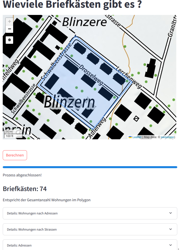
Wie viele Briefkästen gibt es? – Interaktive Analyse der Briefkästen in der Schweiz
<p style="margin-left:0px;"><i>Deutsch</i></p><h3 style="margin-left:0px;">Wie viele Briefkästen gibt es? - Ein Tool für Marketing, Stadtplanung und Logistik</h3><p...2 Datasets Wie viele Briefkästen gibt es? – Interaktive Analyse der Briefkästen in der Schweiz
Additional information
- Identifier
- cb0f8401-c49a-4bdf-aff6-40a7015ba43a@bundesamt-fur-landestopografie-swisstopo
- Issued date
- June 1, 2016
- Modified date
- May 1, 2025
- Conforms to
- -
- Publisher
- Federal Office of Topography swisstopo
- Contact points
- geodata@swisstopo.ch
- Languages
-
- English
- German
- French
- Italian
- Further information
- geocat.ch permalink
- Landing page
- https://www.swisstopo.admin.ch/de/landeskarte-swiss-map-raster-10
- Documentation
- -
- Temporal coverage
- -
- Spatial coverage
- Schweiz
- Update interval
- -
- Metadata Access
- API (JSON) Download XML


