- Ultimo aggiornamento
- gennaio 1,2010
- Condizioni d'uso
-

- Organizzazione
- Ufficio federale di topografia swisstopo
- Categorie
- Regioni e città, Ambiente
Descrizione
Il modello altimetrico MDT25 / 200m é un set di dati che descrive la superficie terrestre in tre dimensioni. Si tratta di una matrice altitudinale con una maglia di 200m. Il modello a matrice è stato sviluppato mediante un ridimensionamento del modello a matrice MDT25 che ha una maglia di 25 m.L’MDT25 / 200m presenta le forme grezze della superficie terreste, senza vegetazione né costruzioni.I laghi sono rappresentati dall’altitudine della loro superficie. MDT25 / 200 può essere scaricato gratuitamente.
Risorse
Bacheche
-
Altiswiss
Die Webapp "Altiswiss" ermittelt den aktuellen Standort, gleicht ihn mit dem digitalen Höhenmodell der Schweiz ab, zeigt die interpolierte Höhe über Meer an (numerisch und analog),...2 Dataset Altiswiss -
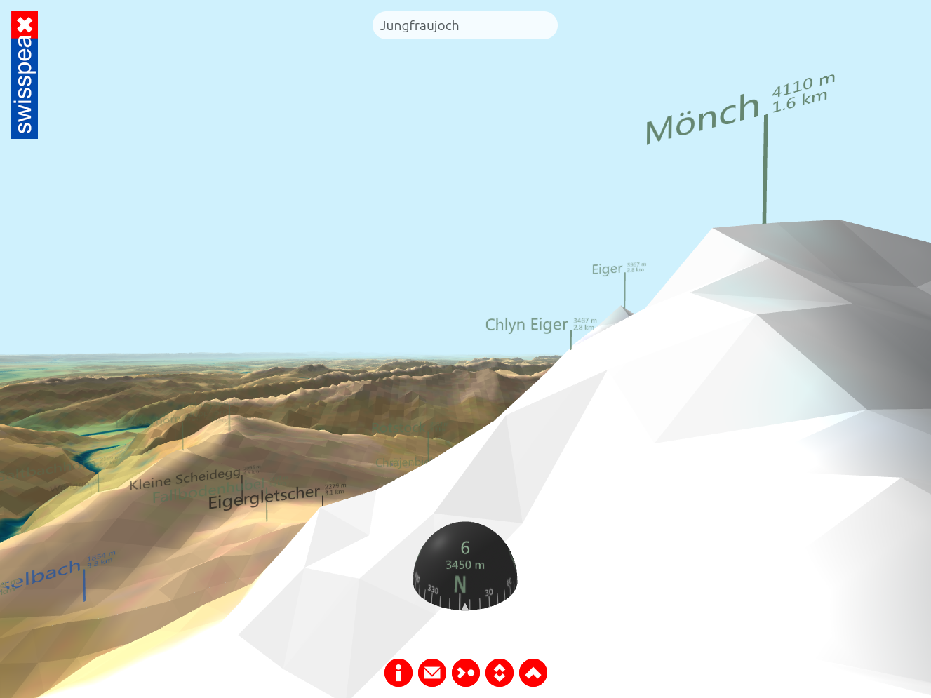
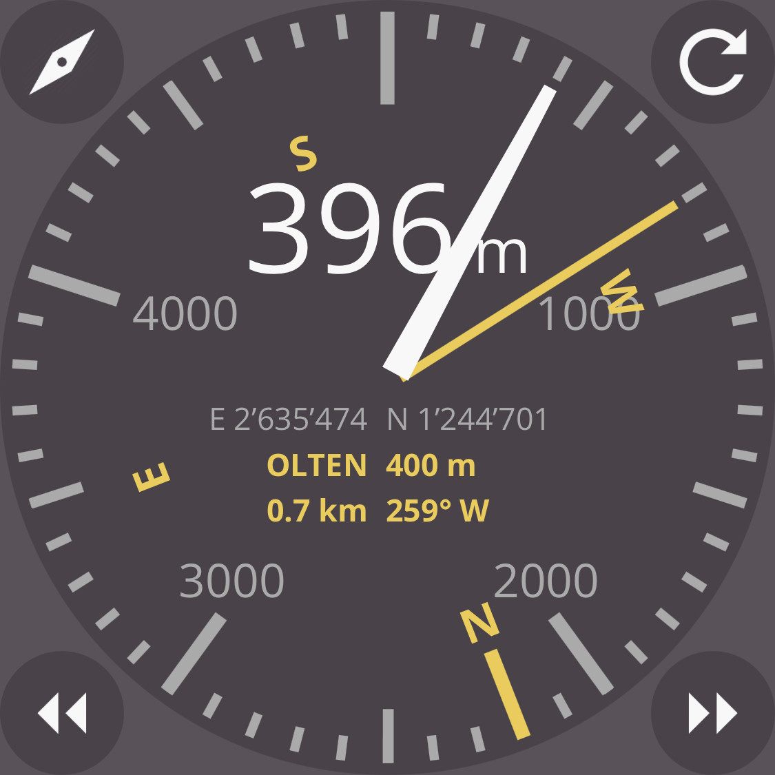
swisspeaX web app
The web app "swisspeaX" displays the entire topography of Switzerland as seen by the user at their actual location. Provided that the user agrees to GPS localization, "swisspeaX"...2 Dataset swisspeaX web app -

MeteoStats
EIne Visualisierung des Schweizer Klimas sowie der Klimaveränderung in den letzten 150 Jahren mittels einer interaktiven Webseite. Grundlage für die Anwendung sind langjährige...5 Dataset MeteoStats -

Minecraft4Switzerland
The map of Switzerland is replicated in the videogame Minecraft using the Opendata maps. Additionally a webpage allows the composition of programs to run inside Minecraft for...1 Dataset Minecraft4Switzerland
Informazioni aggiuntive
- Identificatore
- 7eeb5314-f988-4e70-be61-07bfafc10439@bundesamt-fur-landestopografie-swisstopo
- Data di rilascio
- gennaio 1,2010
- Data di modifica
- -
- Editore
- Bundesamt für Landestopografie swisstopo
- Punti di contatto
- geodata@swisstopo.ch
- Lingue
-
- Inglese
- Tedesco
- Francese
- Italiano
- Addizionali informazioni
- geocat.ch permalink
- Landing page
- https://www.swisstopo.admin.ch/de/hoehenmodell-dhm25-200m
- Documentazione
-
- Copertura temporale
- -
- Copertura spaziale
- DHM25
- Intervallo di aggiornamento
- Mai
- Accesso ai metadati
- API (JSON) Scarica XML

